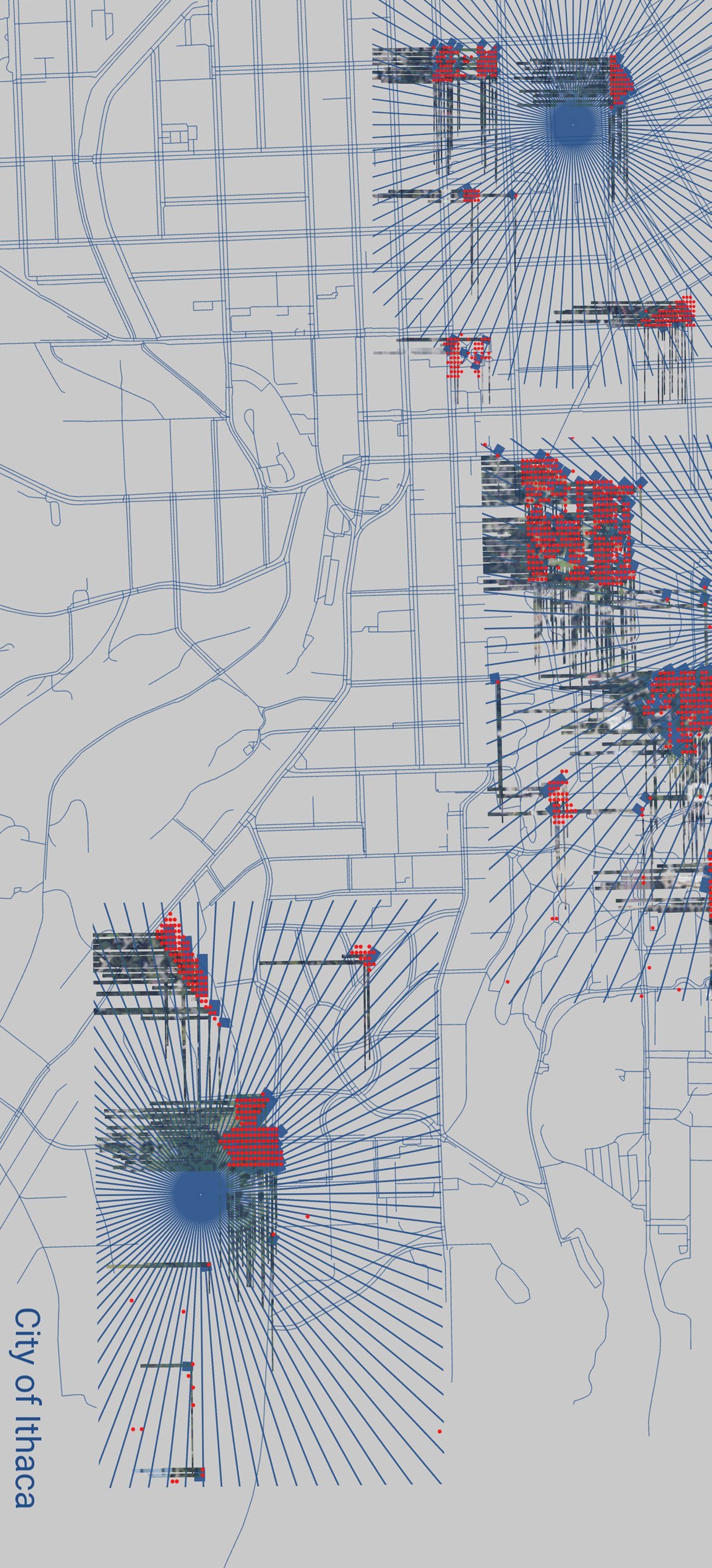
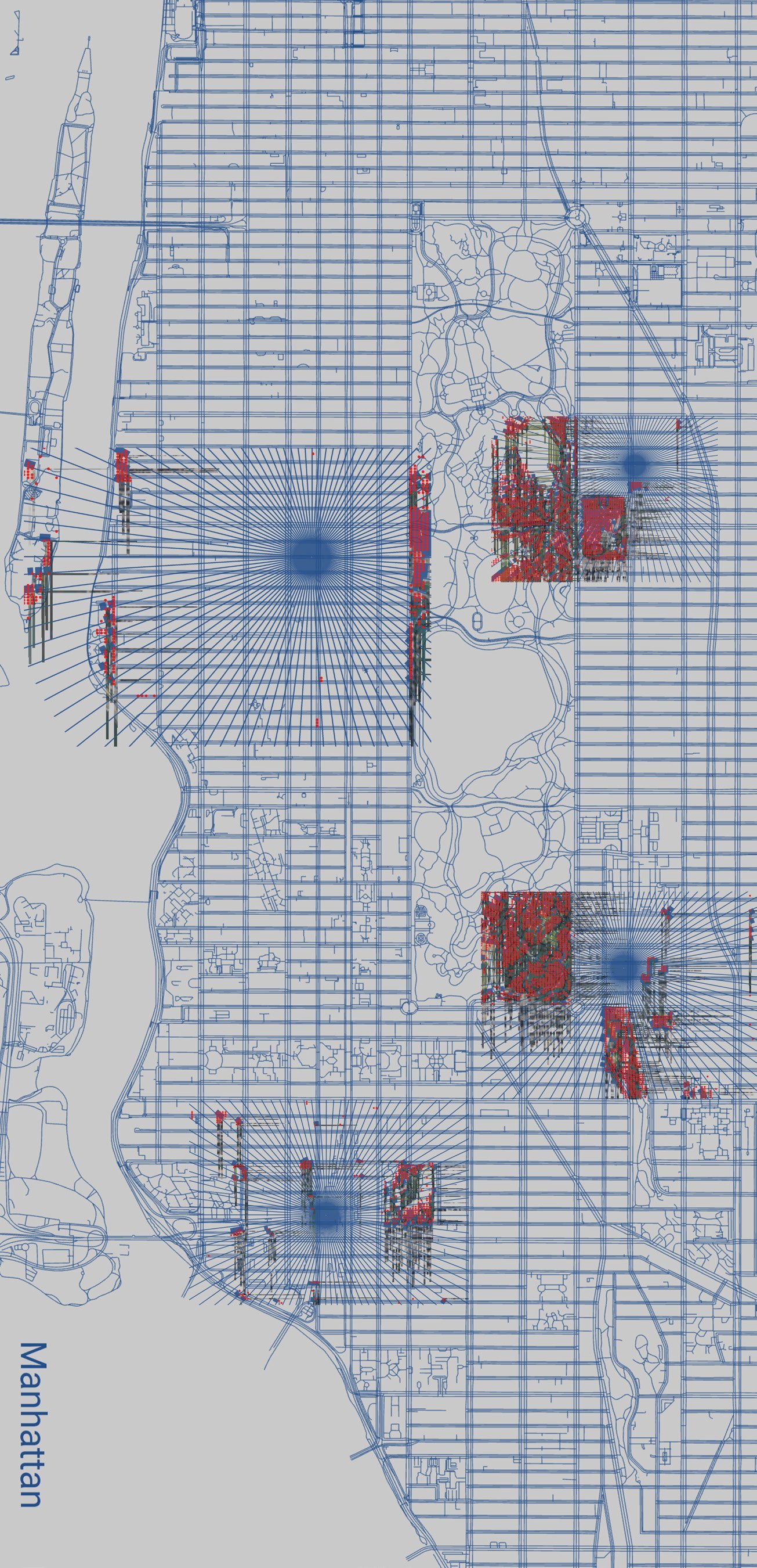
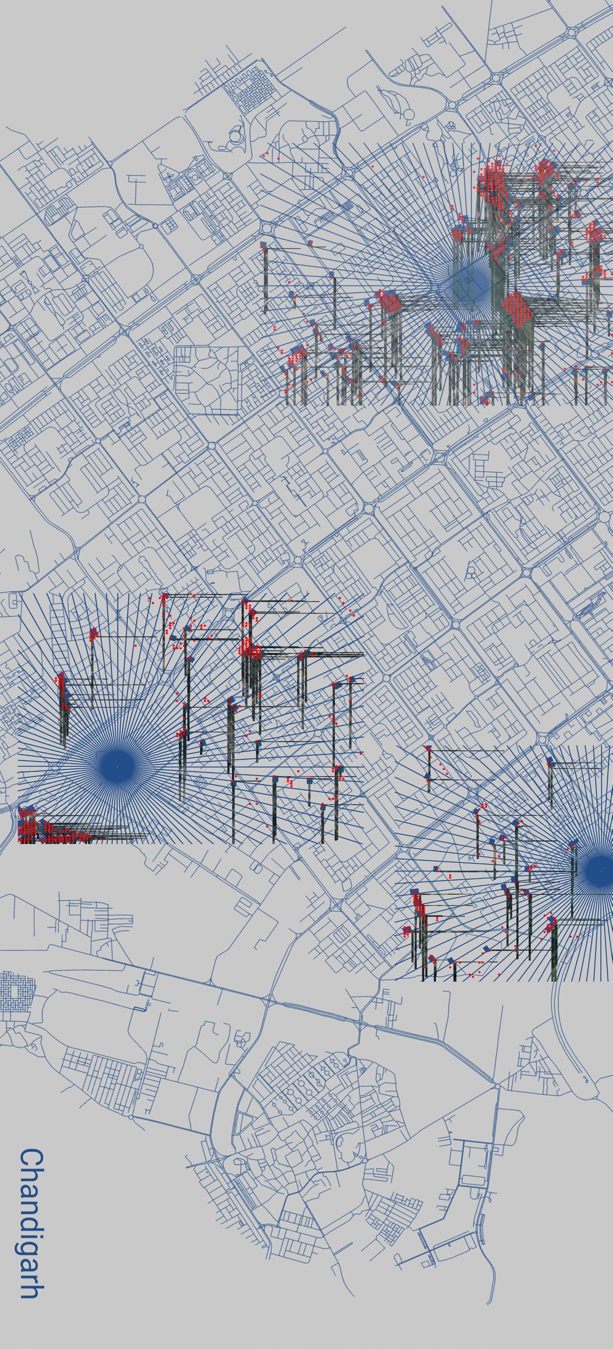
Biophilic Mapping
Fall 2023
Prof. Ryan Whitby
Visibility analysis tool
The project began with a suspicion about biophilic design: that it has become a marketing position more than a measurable condition. Visibility analysis offered a way to test this, using terrain morphology to ask how much nature a person can actually see from where they stand, not how much exists on a green coverage map.
Sightlines are the main way people connect to landscape. This project treats them as data. Code built for the project draws from Google Maps and Google Earth imagery to map exactly how much greenery reaches a given viewpoint, registering what blocks and what opens.
The tool was run across three cities: Ithaca, Manhattan, and Chandigarh, the author's hometown. Each reads very differently once filtered through actual eye-level sightlines. A city that looks green from a satellite can feel visually starved at ground level, and the gap between those two readings is exactly what the project is trying to surface.
The output is a set of visibility maps that show the human experience of nature in a city more honestly than any green space percentage figure.